From the second published journal of the DPC, November 1936
In the High Peak, the more important joints in the limestone run approximately W.N.W. and E.S.E. They are by no means perfectly parallel, but radiate slightly as though from some distant centre. In this series are to be found all the great mineral veins, Odin, Dirtlow, Moss, Earl, Shuttle and Oxlow Rakes among others.
There is also a subsidiary series of joints running nearly N.W. – S.E. and, in the northerly part of Derbyshire at all events, these are found to be very closely parallel. Although some of them show signs of search for minerals, there has not been the same extensive mining as in the other series.
Walking over the surface, one is struck by the number of shakeholes which follow these joints and by the fact that in so very many cases where two lines of shakeholes intersect, a particularly large one indicates a larger cave below. By gradual accumulation of evidence there is slowly being developed a technique of “cavern deduction” from such indications, but discussion of such work is perhaps a little premature.
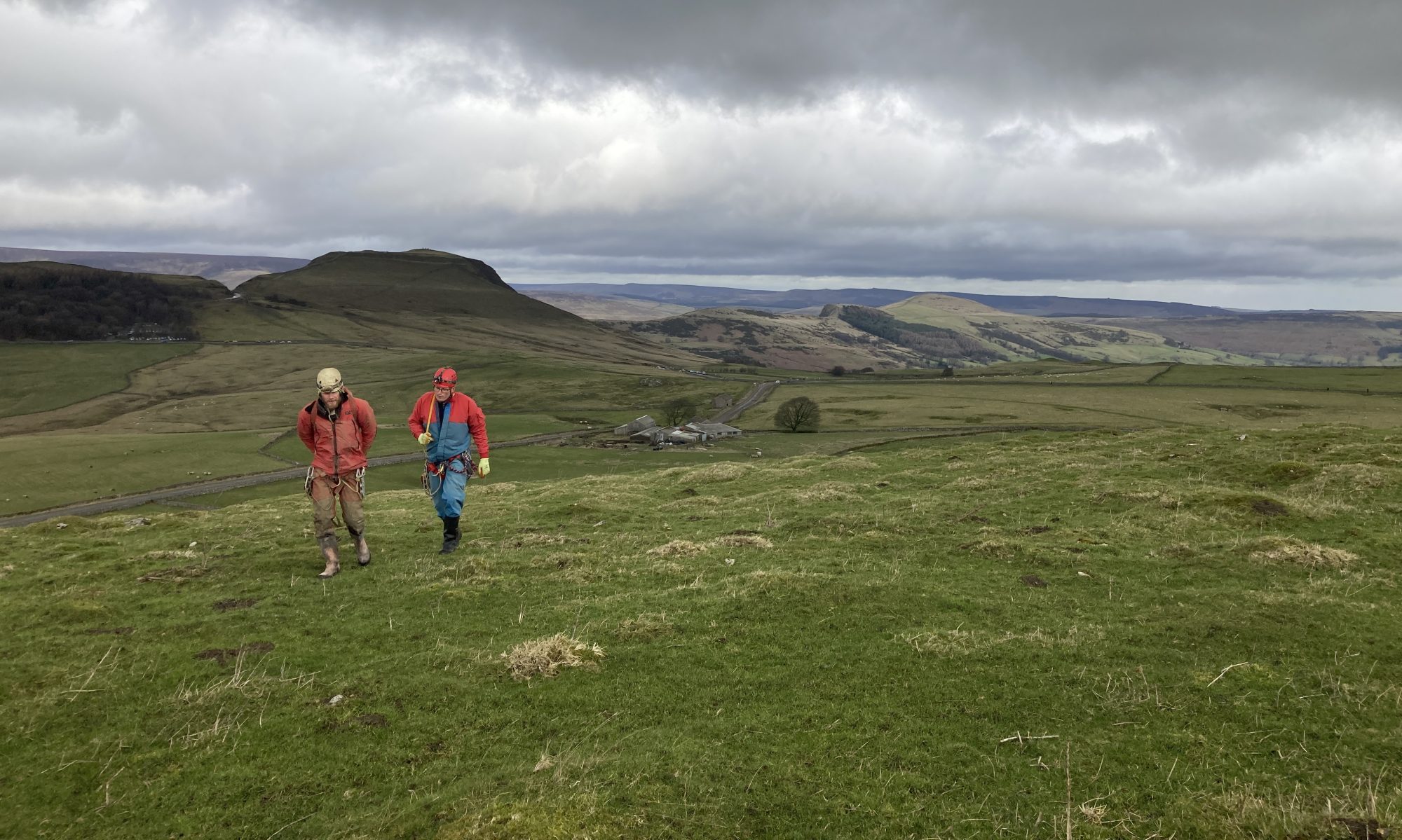
The object of this article is to describe the results of the first effort in this district on serious shakehole work and to give particulars of the present state of exploration of the pot so discovered.
Actually the shakehole opened was one of a line following a N.W. – S.E. joint, and it is interesting to note that below ground it is possible to point out an aven corresponding to practically every shakehole on the line.
The surface indications were merely a moderately large sink (full of nettles) and the first operation was the firing of a spare shot, left over following blasting operations in Oxlow by the D.P.C. At that time it occasioned some surprise that instead of lifting any rock, the shot seemed to blow down into emptiness and on inspections, a small hole was found leading down. Work then commenced in excavation and a full account of the history of it by G.L.Travis can be found in the D.P.C. Journal. Briefly, it consisted of clearing an almost solid choke for about 20 feet followed by the clearing, timbering etc., of another in a bed of loose jointed rock at 80 to 90 feet. This work took considerable time, but afterwards the labour was much easier and comparatively straight forward.
For the first 180 feet vertically, the pot is a vertical joint enlarged by pure solution showing in places beautiful fluting but no polishing as with water bearing debris. The top 90 feet are somewhat narrow, the opening being about 10 feet by 1 feet in places. Below 90 feet, where the final choke was passed, the shaft enlarges considerably and the first stalagmite formations are found. These are discoloured by the washings from a clay bed somewhere above. At about 150 feet down, the area of the shaft again becomes reduced and almost becomes as small as the upper part.
At 180 feet the shaft ends abruptly at a horizontal clay bed, washed out to form a bedding cave into which it breaks near one end. No doubt it continues as a small hole below, but this is concealed by the fallen debris from above, put down in our excavations.
This bedding plane cave is a most interesting place. The roof is, of course, quite clean and solid with here and there fringes of stalactite tracing the few cracks. A point to note is that at this region, there has apparently been some earth movement, or heavy fall, which has broken off the stalactites already existing, and cracked and distorted the stalagmite which had formed to an average thickness of about 2 inches on the remaining clay of the floor. The fallen stalactites in some cases did not roll far and in about four instances may still be seen cemented to their corresponding stalagmite bosses by further deposition, whilst in their places are much smaller successors. The stalagmite shows a very varied fracture entirely crystalline but banded with clay washed down. As there have been several sources of flow to this flat, the bands are not by any means uniform in specimens taken from various parts. In general, it may be deduced however, from examination of a series of fractures, that there must have been a very long period where almost clean water flowed here, followed by a short one where the liquid was very muddy, due possibly to the washing away of a shale band higher up. Further clear crystal follows, but latterly the deposit has been more intermittent and is almost milky.
Returning to the description of the bedding cave, the most notable feature is the manner in which it breaks into a vertical rift of great size at a point near the shaft by which we entered. This rift is a most important feature and will be discussed separately later. For the present it may be stated that it, and all other passages below the clay bed, run at an angle of about 20 degrees to the upper joint containing the shaft by which we entered.
At various points in the bed are small avens running upwards, nearly choked with stalagmite. In the floor also are holes, stalagmite lined, which of course at one time took a fair volume of water. They do not in general bear any definite relation to the avens above and very little to each other and the big hole below. The water they took must, however, have reached the big chasm. Down one of these holes in the floor trickles a small flow of water coming from a small aven nearby. The boundaries of the cave are formed by acute angled banks of clay except at the end remote from our entrance shaft where it terminates at a vertical clay bank. In height it varies from a maximum of 30 inches to a minimum of about 6 inches, the lowest place through which progress must be made being about 12 inches. As it is studded with small stalagmite bosses, the passage of ladder or other tackle is rather laborious. At the S.E. end of the place (the entrance shaft being N.W.), is a vertical hole of the letter box type giving access via a stalagmite arched rat hole to a ladder descent into further regions to be discussed later.
The next point to be discussed is the great rift running longitudinally about half way down the S.W. side of the bedding plane. Here again, one breaks abruptly into the chasm and clambers down a choke of loose boulders falling in a slope to a depth of about 30 feet odd. The width here of the rift is nearly 20 feet. Above us is a large aven, which can be seen going up to some 100 feet, and on the surface is a corresponding very large shake hole. In wet weather, a considerable shower of water descends onto this choke at its lowest part and makes operations most uncomfortable. This water is apparently rapidly dissolving the rocks of the choke, and even the older stalagmite formations on the walls and floor boulders. In the north west corner, at the very lowest part, is a small hole leading over a large jammed boulder to a pitch of 170 feet, and above it a passage leading off in a straight line in a N.W. direction. Following this, the “Stalactite Passage”, one at once gets the impression of being at the top of a long enlarged fault. The passage itself is about 2 feet 6 inches wide on an average, but varies from 12 feet to 1 foot. Its upper portion seems to have been formed entirely by the boring action of water borne rocks, i.e., it cuts across the joint in a rounded arch in contradistinction to the sharply pointed arch of a pure solution passage. All the avens in the roof seem to bear this character as well, but at a point about half way up the side walls of the passage is another clay bed, perhaps 20 feet lower than the big one we first described, certainly unconnected. Below this bed, the passage takes on an entirely different character. The floor is of choked boulders filling the rift passage and for some distance this choke persists. At one point, 2 holes in the choke give access to a drop of 100 feet or so, at present unexplored. Indeed before tackle can ever be put down here, some very heavy timbering and laborious making safe must be done.
At a point about 90 feet from the entrance of this passage, its character changes. One steps off the boulder choke and continues in the stone bored passage for nearly the same distance again. The floor is at the level of the clay bed and is covered with a most beautiful deposit of clear white stalagmite. A trickle of water flows over this and tiny pools contain an entrancingly lovely flower like crystal growth. When first entered, some of these pools were also covered with a deposit about 1/16 inch thick which, unfortunately, has had to be removed in further progress. The passage diminishes in size, turns a double right angle, first right and then left and continues to a point where a large boulder bars progress. This will, if possible, be removed later. Contrary to the case in the rest of the pot, the air in this passage is rather dead. The formation while not profuse, are very beautiful.
The next point for description is the 170 feet pitch now known as “Elizabeth.” The descent is much facilitated by the winch but it is still advisable to ladder as well. Standing on the choke at the top of the pitch one climbs into a Breaches Buoy, which is far more comfortable in the ensuing operations than a great big knot. With this hitched on to the winch wire, one floats gently down, only using the ladder if one happens to be so minded, except for the purpose of stopping spinning. If the guardian angels above allow time, it is quite possible to observe the general structure of the pot at this point. Briefly it is a rift of varying width and may be best described as the big brother of the 100 feet pitch leading to the bedding plane above. At the points where descent is made, the rift is washed out to about 20 feet wide but closes altogether just behind one, the fissure being filled up with breccia. At the other end (S.E.), it narrows and seems to open again, but access is of course, impossible. On the south west wall is a great cascade of somewhat discoloured stalagmite. About 60 feet from the bottom, spanning the rift is a great chock stone, which at first seemed extremely unstable but later investigations make one feel slightly more reassured. One lands on a choke of smaller boulders than the one above, and finds a bank of stalagmited material going up to south east. This bank seems to be a part of the original breccia filling of the rift, which was never removed and has since been so stalagmited as to render it firm.
By climbing this bank there is access to a further large chamber not yet explored but with a tremendous amount of loose material poised for immediate descent when (or when not) required. Below this choked material is a rat hole leading to a 25 feet pitch which has only been descended once, during the September Meet this year (1936). A great deal of loose material was cleared out and unfortunately choked what seemed to be a promising exit to lower regions. Luckily however, it was found possible to climb up a little way at the south east end of the rift, opening into a small hole which may be likened to a glorified saints niche, and here another small hole was found going down 10 feet, through which could be seen a waterfall. The rift here, although a typical brecciated north-west to south-east fracture, is found to be impregnated with definite mineral vein calcite in very small amounts. This is probably a flier from the nearest mineral vein which is about 200 yards or more away. The small hole, on being enlarged, gave access to a chamber about 10 feet high. The waterfall, which is very small, is probably the water found running into a hole in the bedding plane at 180 feet, and comes out of a fissure too small to be followed. It falls into a pool on the floor and runs away to the north-west i.e., towards the choke at the foot of the big drop. The passage it follows is unfortunately very small and it will be a problem as to how to follow it. It should, however, be followed if possible as if there is water flowing it seems quite likely that the rift will continue down below the choke. It is certain that we are nowhere near any saturation level by a matter of some hundreds of feet.
This is the lowest point yet reached, about 420 feet from the surface, and it seems rather unsatisfactory that we should be left in such doubt as to the next move. Somewhere below us the waters of the three (if not four) flows found at 200 feet should unite and then, when a sizable stream is produced, work should be easier.
One passage alone remains to be described and this starts from the clay bed at 180 feet. At the south end of the bed, through the letter box, is a pitch of about 70 feet. This is found to be tremendously water worn and an aven going up must pass the clay bank terminating the bedding cave. Curiously no great volume of water has been noted here even when there has been much coming into the big chasm. Perhaps its course has been diverted, for a few feet along the passage about to be described, an aven brings down a small flow which disappears in a tiny pool in the floor. The shaft divides into two, about 30 feet down the ladder pitch, and luckily the ladder hangs clear of the division, for the water corroded rock is very loose. At the foot of the ladder passed a very loose choke is a further unexplored drop of about 100’. But half way down the pitch, where it divides, one steps off the ladder on to a convenient flake and climbs into a passage running S.E. Passing the aven just mentioned, the passage assumes the characteristics of the N.W. stalactite passage, stone bored in its upper part. The floor is of the clay bed for some few yards, passing on to choked boulders for the remainder of its 190 feet course. Here however, the roof seems almost to disappear and a complex system of avens is found, two bringing down water in small volume. At one point a vein of crystal clear calcite is being washed out. The calcite is most beautiful showing the usual columnar crystals starting from many small nuclei on the walls, terminating in triangular prisms instead of the usual dog tooth form. As the vein was apparently never filled, one finds none of the equiaxed crystals in the centre, such as are usually present.
In the boulder choked bed of the passage, two more holes give access to an unexplored drop of perhaps 90 feet or more, confirming the impression that the whole of this lower part is a vast boulder and breccia filled fault, with these cavities washed out. Finally, the passage ends by a small hole leading to a beautiful stalagmite draped chamber. Curiously enough in this passage, hardly a single sizable stalactite is to be found, although the stalagmite cascades on the walls are what one might describe as luxuriant.
So much for the bare description of the pot. In its present state of exploration it may be too early to discuss its physical features, but as a sporting cave it has few superiors in this country. It is not wet in the sense that so many other caves are wet, with large streams flowing, but its surface drainage is amply sufficient to add spice to the descent. Nor does it take the surface drainage from a large area, for in its immediate vicinity many other shake holes on the surface would indicate similar caverns below. In the past however, before the water swallets became abandoned and choked, a very considerable volume of water must have come down.
One thing however, is most striking about this pothole. That is, its great possibility for further excavation and exploration. A very great deal of work has been done, only a visit can show how much, but years of work are ahead. And when it is realised that this is just a minor pot on the system of the Peak Cavern waters and that many more, some of which seem to be greater, remain entirely virgin ground, the vastness of the field becomes apparent. And the Peak Cavern system is only one of the Derbyshire systems. Indeed it is the only one of which more than the bare existence is known. Water cave work on this ground has reached the stage where the more one does, the more one finds to do. All of it of course is digging, and I suppose that in all other cave districts the same conditions hold good.
As regards the general relation of Nettle Pot to the rest of the Peak Cavern System, it would appear that it is the first pothole to be discovered of a whole series, which form a vital link in the conduction of the Rushup Edge water to the Peak Outfall.
It has been known for a long time, that certain of the major swallows or water passages such as Eldon, Bull Pit and Giants Hole, run in a N.W., S.E. joint, but not until Nettle Pot showed that these joints persisted, to considerable if not great depths, was their full importance realised. It was at this time that the joints in the district in question were very roughly grouped into the 2 classes and it was then found that each class had well marked characteristics of its own, even if they broadly seemed to merge one into the other.
For instance, the E-W series is mineralised. That is to say that the rake veins have a strike in this direction. Now, although from each rake there are a greater or less number of scrins branching at a large angle, there is no general mineral bearing series running N.W. – S.E. in this immediate area.
Again, the mineral veins often, indeed mostly, show slickensiding in a nearly horizontal direction and this with the displacement of the toadstone sills (shown very clearly on the 1 inch Geological Map) would indicate that they were formed by lateral shearing. On the other hand the N.W. – S.E. joints do not show this and mostly, the position of the bedding shows a vertical displacement.
The mineral veins again are usually cleanly filled with mineral, and although in many cases lumps of stone are found in the veins, they are by no means general, as in some other districts and other formations. Here again they differ from the N.W. – S.E. fractures which are definitely characterised by breccia and loose material.
This is the case at Eldon, at Nettle Pot and at Bull Pit. The lower parts of the fracture at Eldon and at Nettle Pot bear a striking resemblance, and again the upper part of Eldon is very like Bull Pit.
It seems reasonable to assign different causes to these two classes of fracture and different periods. A probable explanation might be, that the rake vein fractures took place at the time during which the Pennine uplift took place in Permo Carboniferous times. Further if we apply the hypothesis that the mineral veins were formed by extrusion of residual solutions from an acid magma, the contortion of the continental granitic layer at this time, would supply the necessary source of these veins, although it must be reserved that a long period must be allowed during which the veins were filling, to account for various observed phenomena in connection with them.
When the mountains were raised, whether in one, or as seems more probable, in several stages, the limestone was certainly covered by far more of the shales and grits than we see today. We find the remains of these rocks as caps and debris covering the higher summits in this district and of course there is the obvious example of Ingleborough to show how these overlying measures have been denuded over the greater part of the limestone areas.
During this denudation there would naturally be a great variation in the stresses applied at various points, and these variations would give rise to many minor earthquakes and landslides, in the same way as it is held that the earthquake zones of the present day are undergoing stress relief, following the most recent mountain forming period. If these isostatic phenomena are allowed, here is surely an explanation of the N.W. – S.E. series in our district which, much brecciated and broken up, and apparently not so deep seated as the other class, would fulfill all the required conditions.
At any rate, it would appear that the N.W. – S.E. joints are much younger than the E.-W. series, and when they became uncovered by denudation, not being mineralised, would provide a ready descent below ground for the water coming off the shale caps. It is to be observed that most of the shake holes and choked swallets in the Peak System, lie in obvious lines in this series.
To sum up then, the Peak system may be defined as being fed by surface drainage of the limestone itself, plus the drainage from the shales of Rushup Edge now to be seen feeding the swallets at the foot of the slope of this hill.
As the shale has been denuded, it has gradually reached its present contours by uncovering a large area of limestone crossed by N.W. – S.E. joints which now contain the choked swallets, abandoned by the water during the retreat of the the hill slope. It is to be noted that from the top of the Beet northward, such choked holes seem to decrease in size, due probably to a de¬crease in the amount of water flowing, which in turn is connected with the cutting of the Edale Valley, and the diversion into the River Noe, of much water which would otherwise have finished up at the Peak outlet.
The first part of the course of this water, is along one or other of the many of these N.W. – S.E. joints, which provide the requisite vertical and horizontal component leading the flow to the S.E., until it reaches either New Rake or Dirtlow Rake, when it turns and flows east. One or both of these two Rakes acts as a master cave, in collecting all the various minor flows which reach them.
At the extreme west of the system, the water runs almost directly into Dirtlow Rake, or rather its western continuation. The B.S.A. Records possess a plan of Coalpithole workings, showing the water from one of the swallets reaching their workings after a S.E. course of very few yards. During this time, it must have dropped a considerable distance vertically, as an independent reference in the Government mineral sources memoir, refers to a strong flow at 40 fathoms in the workings. Unfortunately, as it is obscure as to where the 40 fathoms is measured from, it would be misleading to try to construct a section at this point.
From here westwards, there can be no doubt that the stream flows along the Rake, as these Perryfoot swallets have been proved to emerge at the Peak Cavern, since there is not a big, vertical distance from Perryfoot to the Peak outfall at Castleton. In spite of 4 miles or so of horizontal distance, there must be a fairly uniform flow of water without deep drops, the whole way. But the water passage has never been reached (to living knowledge), by mining operations, along the rake, in spite of the several deep mines on the hills above.
It is also unknown how the toadstone sill, which is crossed, affects the flow. South of Dirtlow Rake, it appears to divert it somehow, but this question must be discussed at a later date, with the Bagshawe Systems and those feeding the upper Wye.
The Dirtlow Rake water would appear to leave the rake suddenly, by a N.W. – S.E. joint, just above Pindale, and finish up at Buxton Water. Incidentally, Pilkington (1789) refers to a cave in a mine which must be at about this point, and there are indications of a choked swallet here, just off the rake, which might be looked into sometime. Also the deep hole near the Club Hut.
Finally, the New Rake water seems to reach Cliff Cavern after a similar easterly course. This water reaches Peak at a point known as Speedwell Water in the Peak. It does not all seem to pass through Speedwell, but its course was interfered with during the operations in the Speedwell Mine.
The course of the water from this point to Peak is at present unknown, but when first Cliff Cavern was discovered, the stream was followed for a considerable distance until stopped by “too deep water.” Permission to work Cliff Cavern is not available at the moment, and the following up from the Peak is out of bounds of present possibility, so that the only point of access to information seems to be the investigation of the Hurdlow Pipe Vein lying between the two; an eighteenth century plan and (?) section of which, are in the B.S.A. records.
It should be borne in mind that this summary is in no way exhaustive, and that when the survey in progress is completed, details may have to be altered. It is not expected however, that any broad principles will be affected.
